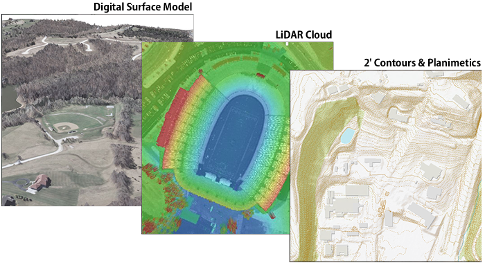
LiDAR is a remote-sensing technology that uses laser pulses to measure surfaces and objects in three dimensions. Millions of data points are collected from a sensor that can be mounted in a variety of aircraft and ground-based mobile platforms.
LiDAR is the predominant method for county-wide topographic mapping and elevation modeling in Missouri. The technology has changed the way elevation data is acquired and processed, and has made topographic data more accurate and affordable.
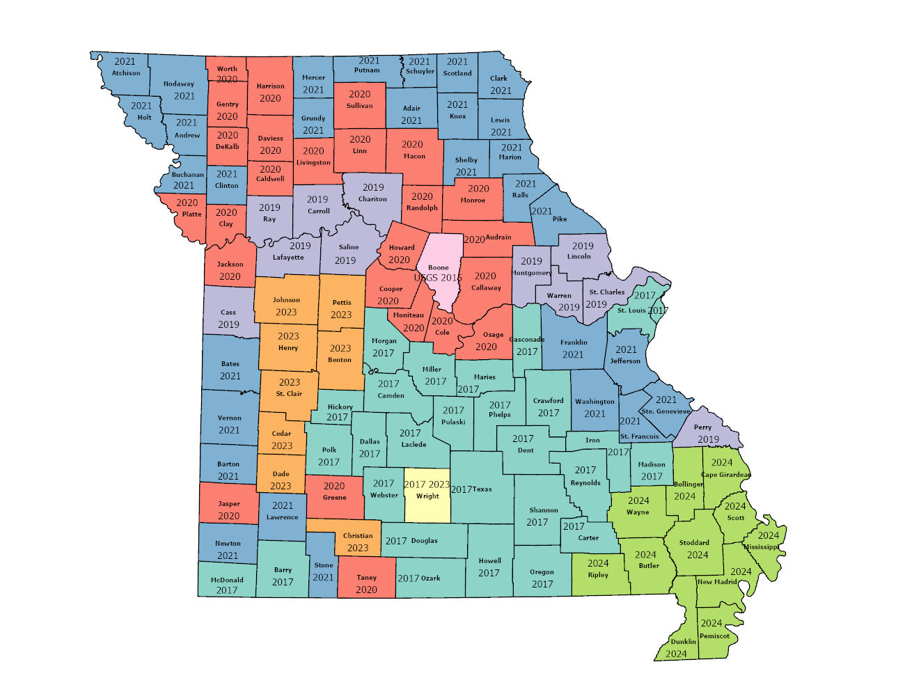
Available LiDAR imagery for Missouri
LiDAR data for Missouri is a blend of data collected for specific projects, and data collected by federal programs (USGS, NRCS, FEMA, USCAE). Specific project data is hosted by the University of Missouri and Washington University.
Missouri’s LiDAR is blend of QL1, QL2 and QL3. These quality levels (QL) help users assess the usability of each level for a particular purpose. Levels identify both accuracy and spacing between the points, with QL1 being the highest level. The majority of the LiDAR data for Missouri is at QL2.
To learn more, open the Missouri Map and turn on the layer “LiDAR – Project Level Metadata”. This give you the ability to download specifics for each of the holdings.
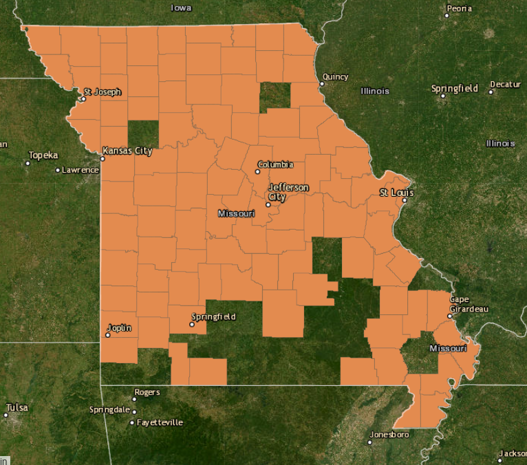
2023-2024 projects
Missouri utilizes LiDAR sponsored by federal programs for most of this data. Parts of the state are older or have a lower QL levels. In 2023, a partnership between Departments of Conservation and Natural Resources was formed to pool available funds. These agencies identified priority area by region, beginning with watersheds in the boot heel region.
To explore the federal holdings of LiDAR data, visit the USGS LiDAR Explorer Map.
There are multiple LiDAR collections currently underway. The processing time between data collection and the availability for download is much longer than an aerial imagery project – measured in years, rather than month.
When all data collection that’s underway or planned for 2023 and 2024 is complete, Missouri coverage will be complete for at least QL2. Check this site, the Missouri Map and LiDAR Explorer from USGS for updates.