The technical term for the type of aerial imagery described on this site is orthophotography. Simply put, an orthophoto is an aerial photo with the distortion of elevation removed so it can be used as an accurate base map for computerized mapping systems. Removing the distortion allows for the accurate measurement of distances, calculation of areas, determination of the shapes of features and performing accurate change detection. Orthophotos are commonly used for asset management, Census, tax assessment, flood mapping, planning, and economic development.
Orthophotography has been the foundation of local and regional mapping efforts in Missouri for years. Prior to the digital age, orthophotography was generated as a film or mylar product.
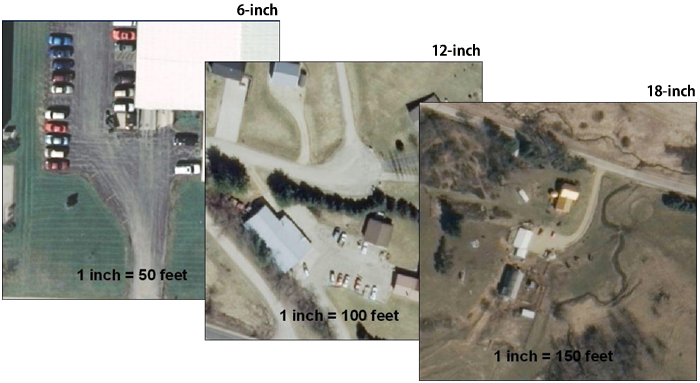
Sensor (digital and film camera) technology and processing software continues to improve the quality and accuracy of the ortho datasets. At the same time, higher pixel resolution imagery is becoming more affordable. Many counties can now afford to use 6-inch resolution or even 3-inch resolution in cities.
State-wide orthophotography, or aerial imagery is available as a streamed service from Missouri’s GIS clearinghouse, hosted at the University of Missouri. For users who prefer to have the data files, the Missouri Map is set up to discover and download this data.